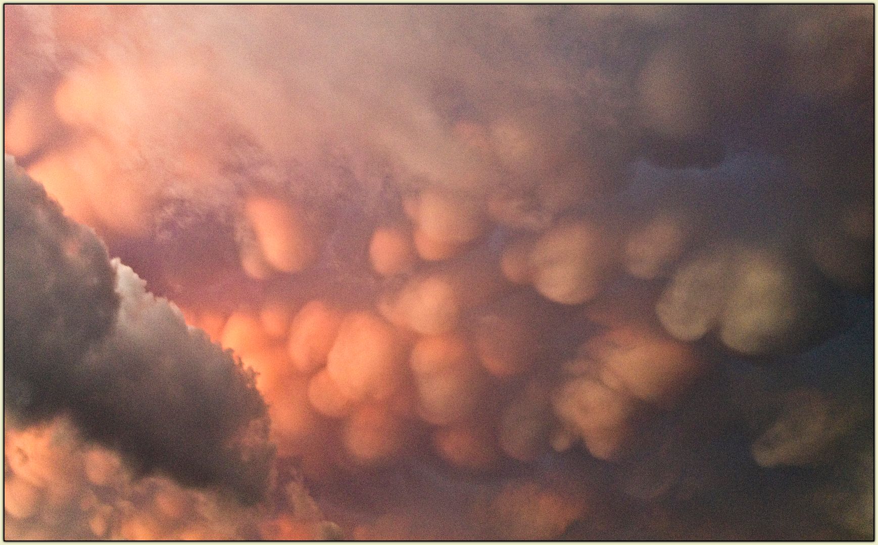
Unusual mammatus clouds in the eastern sky over Marietta, Georgia, a harbinger of nasty weather.
Last night as our Thursday evening Minyan Gang was polishing off the remains of our supper at the local diner, we noticed an ominous darkness gathering toward the east... an inky greyish-black sky that could not be explained solely by the fact that the sun was setting.
A quick check of the Weather Channel radar maps (ain’t smartphones smart?) established that Nasty Business was indeed brewing. Unlike most springtime nastiness, however, the storms that were building were coming in from the east rather that the west. Bizarre.
We stepped outside and were greeted by a rare sight: mammatus clouds.
Also known as mammatocumulus clouds, these clouds get their name from their resemblance to udders or breasts... which is why I refer to them as Sky-Tits on those uncommon occasions when I see them. They are sometimes associated with very severe thunderstorms, so I was more than just a little nervous as we piled into the car to head home.
Surprisingly, we encountered no bad weather of any kind as we worked our way eastward. A few drops of rain was the most we had to deal with, although the distant eastern sky was lit intermittently by huge crackling flashes of lightning. But as we approached our neighborhood, we saw evidence that the drama we had seen in the sky had been matched by drama on the ground.
The area was completely covered in leafy detritus, the sort of thing you would see in the aftermath of a hailstorm. But the sheer amount of shredded leaves was astonishing; we had never seen anything remotely like it. Later we found that a violent hailstorm had passed through, with hailstones up to one inch (!) in diameter piling up on the ground in sufficient quantity to mimic a snowstorm. But by the time we got there it had all melted, leaving only shredded shrubbery as evidence.

The driveway at Chez Elisson, carpeted in shredded shrubbery after the storm.
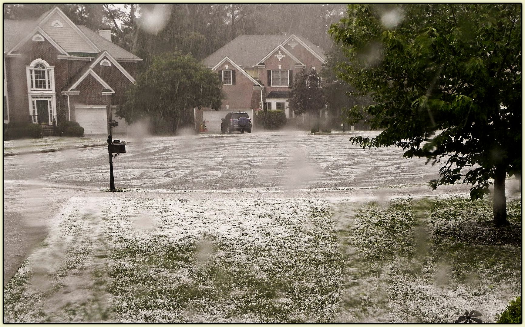
I’ve seen hail like that only once, at Stapleton Airport in Denver back in March of 1992. It fell thick and fast, enough to pile up in drifts. And then, in the warm spring air, it melted away in minutes as though it had never been there. This storm must have been like that.
In fact, it was exactly like that - as evidenced by this photograph taken by one Dean Sever, who lives just over the county line from us in Roswell, a distance of about two or three miles:

It would have made for an extra bit of excitement had we been there to see it. But it’s just as well we missed it. Who the hell needs a car with a pebble finish?


3 comments:
That photo is incredible. With the recent tornado outbreak in the DFW area, I had one of my managers send me pictures of golfball sized hailstones. Impressive, but in 1995 a storm hit Ft. Worth where grapefruit sized ice balls fell from the sky. I was tucked under a bank drive-thru at the time. S C A R Y!
-Morris William
I remember that 1995 storm. I wasn't in Fort Worth at the time, but I was in Dallas on business shortly afterward... and the plane's wings had all kinds of dings in 'em. Yeef.
Oh wow o.o
We're just above the equator and get only two sorts of weather : hot and wet and humid, or hot and humid.
Hang on, I remember you've BEEN here! So you know! :D
Anyways, I am in awe of the confetti-ed shrubbery.... I don't suppose you could post a picture of the torn leaves itself? This just blows me away.....
Post a Comment